




After Nepal’s catastrophic flood, scientists watch for what comes next
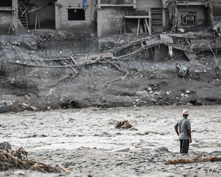
The massive rock-and-ice collapse has left behind unstable terrain and metres of debris that could trigger further floods and landslides, experts say.
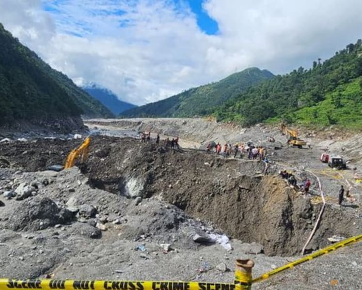
Nepal Army soldiers and rescuers work during a search-and-rescue operation near Hydropower Project sites, following deadly flash floods and mudslides, in Rasuwa district, Nepal, in this handout obtained by Reuters on Sep 1, 2026. (Photo: Nepal Army/Handout via Reuters)

This audio is generated by an AI tool.
A week after a high-altitude collapse of rock and glacial ice sent water and debris surging across the Nepal-Tibet border region, scientists are closely watching the affected Himalayan valley for signs of further danger.
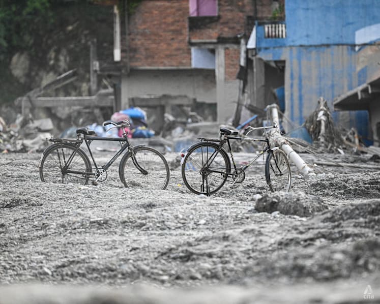
Experts warn that while the initial torrent has passed, it has left behind weakened terrain and huge amounts of mud and rock that could be set in motion again by monsoon rains.
Maximillian Van Wyk de Vries, assistant professor in natural hazards at the University of Cambridge, described the disaster as a “multi-hazard cascade” – where one hazard triggers another in a chain of events.
“This was a landslide of rock and ice that then cascaded and triggered this massive flood that caused so much damage. And we know there have been secondary landslides that have been triggered by it,” he said.
Van Wyk de Vries told CNA’s Asia First on Wednesday (Sep 2) that scientists are closely monitoring both the source of the original collapse and the valley downstream for potential hazards.





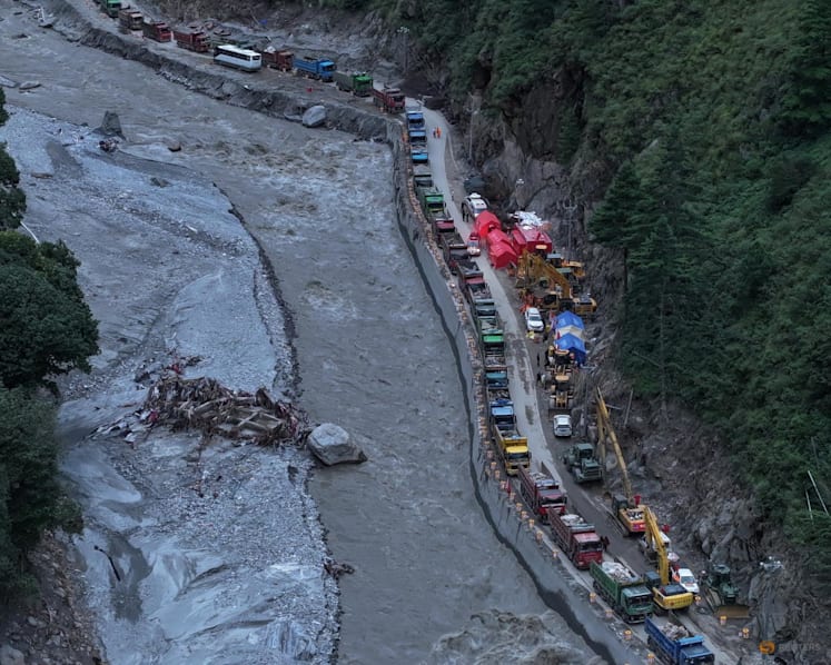
“There's the possibility of future collapses around the source area that's been weakened. But also all the way down this valley, it's coated in several meters of mud and rock, all of which, if there's heavy rain, can be picked up again and become a new flood.”
Satellite imagery is helping scientists track changes across the difficult terrain, but there are limits to what can be detected.
Van Wyk de Vries said ground-based data is being incorporated into satellite data sets, with satellite monitoring able to detect some landslides that show warning signs such as cracks on a hillslope or early movement.
He said that researchers were seeing some early indications that the area involved in the glacial collapse may have displayed such signals.
But other landslides can occur without warning signs visible from satellites, with scientists instead having to rely on weather data to predict them.
STRENGTHENING DISASTER PREPAREDNESS
Predicting where the next landslide or flood may occur is only part of managing risks.
Whether a hazard turns into a humanitarian disaster is more complex and involves factors such as exposure and vulnerability, said Benjamin Horton, dean of the School of Energy and Environment at City University of Hong Kong.
“Exposure (means) putting people in harm’s way, and then vulnerability, the resilience of those communities in terms of a lack of a warning signal or poor building code,” Horton told CNA.
Reducing the toll from future disasters would require authorities to look at not only the hazards themselves, but also where people and infrastructure are located, and how well communities are prepared for them.
He said better data sharing and greater investment in monitoring would be needed to identify where future disasters could occur.
“We need data transparency on all sides so we can understand where the hotspots for the next disaster will occur,” he said.
He also called for further investment from the scientific community in more comprehensive monitoring programmes.
But the scale and complexity of the Himalayas make that a difficult task.
“There are many, many glaciers across the Himalayas so monitoring all of them is an extremely challenging task,” said Van Wyk de Vries.
Every glacier and its surroundings are also different, with no “one-size-fits-all approach”, he said.
While glacier retreat or glacial thinning occurs gradually over years, a glacier collapse is a rapid event.
In the Nepal disaster, a landslide of rock underneath the glacier pulled some of the ice with it, although scientists are still working to understand the exact details of the collapse.
For Van Wyk de Vries, one of the biggest lessons from the disaster is that authorities should look beyond the valley where the flood occurred.
“I think what we really need to do now is take a look at this exact flood and see this flood could probably have happened in about 100 other valleys across the Himalayas,” he said.
Echoing Horton’s emphasis on warning systems and location of infrastructure, he said such considerations should be applied across the entire mountain range.
A WARMING BACKDROP
Climate change adds another layer of risk to an already complex mountain environment.
“In the Himalayas, the temperatures have increased over 1°C in just 50 years,” said Horton.
In an environment containing large quantities of ice, even small changes in temperature can have significant consequences.
Horton said climate change was increasing the frequency of extreme events.
“Commonly what we find with extremes, be this a landslide or a flood, or you think about a heat wave and a wildfire, or you think about typhoons, is that they're virtually impossible at this scale, at this frequency without climate change.”
But determining how much climate change contributed to a specific event such as the one in Nepal is more difficult.
Van Wyk de Vries said that while climate change had “certainly” caused glaciers in the area to retreat more rapidly, whether that glacier retreat made this event more likely or increased its magnitude is harder to establish.
“I would say that attributing this specific event to climate change is very challenging right now, and that there's still a lot of work to be done.”